I have it here set so the water column is not being displayed

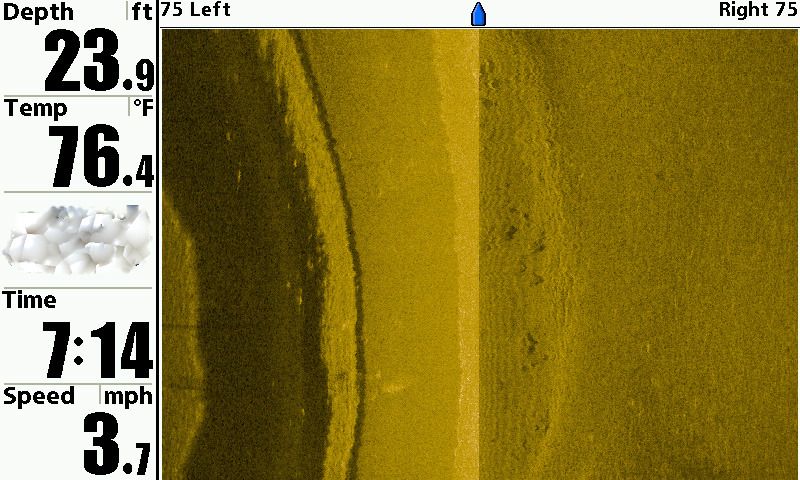
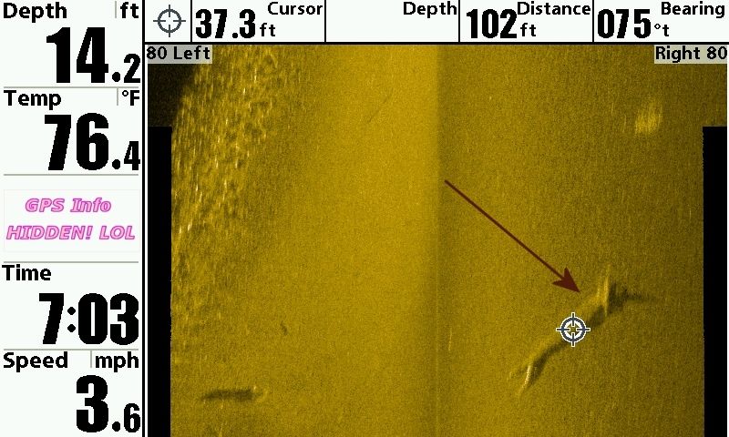
kantuckyII wrote:A couple weeks ago, I got a 5.5 lbs bass about an hour or so after dark in about what I thought was 12' of water. I caught a 4 lb bass from the same location early this summer. I wondered what was down there holding them. The first one was a passing thought, the second was more of than just a passing thought. Well, after having Malones Marina in Ironton install my depth finder for me last week with Side Imaging, I now know...for this evening, I scanned that area and here's what I saw - the arrow marks where I hooked both those fish but it's around 14' of water
I have it here set so the water column is not being displayed
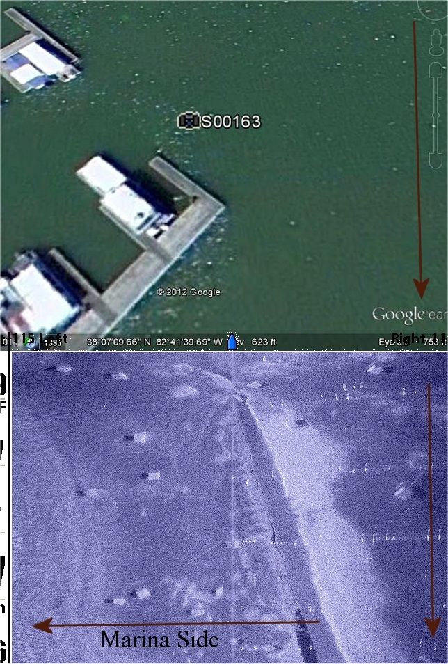
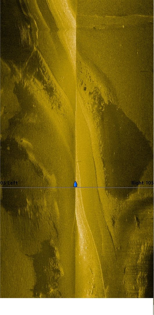
The way it winds and twist arounf like you said, I think it is more likiely an old creek channel rather than a road bed.kantuckyII wrote:Here's 3 images stiched together that show an old roadbed. I knew there was one in the area but never dreamed it twisted this way but it's clear to see what it is
Well, perhaps LOL however if you stretch the picture out you can see some white streaks in it. Also, I had the graph set up to record 160 feet at the bottom, and that is spread over 8 inch diagonal screen. In other words, at those dimensions it might be likely that a fish would not show up on the screen.wink wrote:kantuckyII wrote:A couple weeks ago, I got a 5.5 lbs bass about an hour or so after dark in about what I thought was 12' of water. I caught a 4 lb bass from the same location early this summer. I wondered what was down there holding them. The first one was a passing thought, the second was more of than just a passing thought. Well, after having Malones Marina in Ironton install my depth finder for me last week with Side Imaging, I now know...for this evening, I scanned that area and here's what I saw - the arrow marks where I hooked both those fish but it's around 14' of water
I have it here set so the water column is not being displayed
Don't all the pro gurues say that fish will travel miles back to where they were caught? I don't see a 4 OR a 5.5 pound fish setting on that log...... in fact, I don't see a fish anywhere in all that water. I think you paid big bucks for a hoax.